Kailāsa · Gang Rinpoche · Tise

Mount Kailash

A 6,638 m pyramid of black rock and snow in far-western Tibet — holy to four religions, the source region of four great rivers, and never climbed. Pilgrims do not go up it. They walk around it.

At a glance

6,638mHeight of the summit — 21,778 ft. Modest by Himalayan standards, and unlike anything else
4Religions hold it sacred: Hinduism, Buddhism, Jainism and Bon
52kmLength of the kora, the pilgrim circuit around the mountain — usually three days on foot
~5,630mDolma La, the high point of the kora and the hardest hour of the pilgrimage
4Great rivers rise nearby: the Indus, Sutlej, Brahmaputra and Karnali
0Recorded ascents. Climbing is not permitted, and no one has stood on top

Kailash stands in the Kailash Range of the Trans-Himalaya, in Burang County of Ngari Prefecture, Tibet Autonomous Region, China — about 100 km north of the point where India, Nepal and Tibet meet. The nearest settlement is Darchen, at roughly 4,600 m, where the kora begins and ends. Lake Mansarovar lies some 30 km to the south.

One mountain, four faiths

Few places on earth are sacred to so many people for so many different reasons. Each tradition has its own name for the mountain and its own account of who lives there.

Hinduism

Kailāsa the abode of Shiva

Shiva sits here in meditation with Parvati; the Ganga falls from his hair. The Puranas describe Kailash as the pillar of the world, with faces of crystal, ruby, gold and lapis lazuli. Lake Mansarovar was first formed in the mind — manas — of Brahma.

Buddhism

Gang Rinpoche precious jewel of snow

The home of Demchok (Chakrasamvara), a deity of supreme bliss. Tibetans tell how the poet-saint Milarepa defeated the Bon master Naro Bönchung in a contest of powers here, riding a sunbeam to the summit.

Jainism

Ashtapada the eight steps

The place where Rishabhadeva, the first of the twenty-four Tirthankaras, attained liberation. Jain pilgrims have come to the region for centuries.

Bon

Tise the nine-storey swastika mountain

The seat of spiritual power in Tibet’s pre-Buddhist religion, where its founder Tonpa Shenrab is said to have descended from heaven. Bon pilgrims walk the kora anticlockwise.

The centre of the world. In Hindu, Buddhist and Jain cosmology Kailash is identified with Mount Meru, the axis around which the universe turns.

Merit in numbers. Tibetans hold that one kora clears the sins of a lifetime and 108 bring enlightenment. Some make the circuit by full-body prostration, which takes about three weeks.

The Year of the Horse. A kora made in a Horse year of the Tibetan calendar is counted as thirteen. 2026 is one; the next is 2038.

The mountain

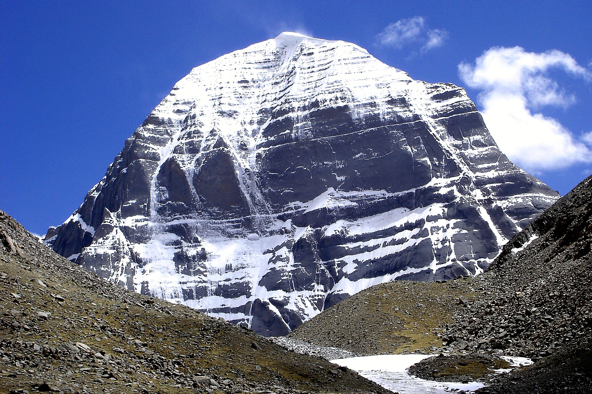
Kailash looks built rather than formed: a four-sided pyramid standing apart from its neighbours, its faces turned almost exactly to the four points of the compass. The rock is layered conglomerate, and the horizontal bands hold snow in lines that pilgrims read as a staircase or a swastika on the south face.

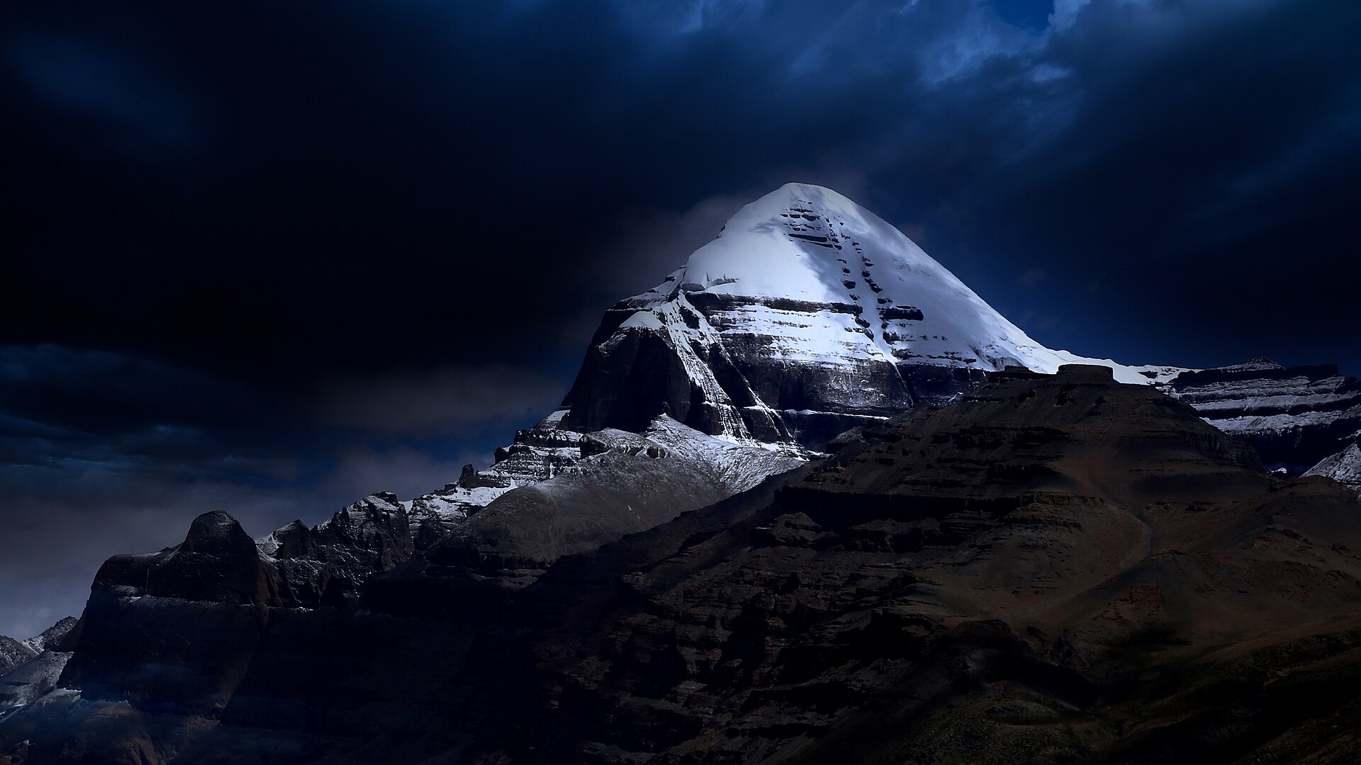
From the plain to the south it rises as a white dome above brown hills. From the north, at Dirapuk, it is a sheer black wall 1,500 m high streaked with ice — the view most pilgrims carry home.

Four rivers begin within about 100 km and run to four different seas of the subcontinent. Tibetans name each source for the animal mouth it is said to flow from:

  • NorthIndus — Sengge Khabab, the lion’s mouth
  • WestSutlej — Langchen Khabab, the elephant’s mouth
  • SouthKarnali — Mapcha Khabab, the peacock’s mouth
  • EastBrahmaputra — Tamchok Khabab, the horse’s mouth
Mount Kailash seen from the Barkha plain
Kailash from the Barkha plain to the south, with the vertical cleft and banded snow of the south face.
Lake Mansarovar
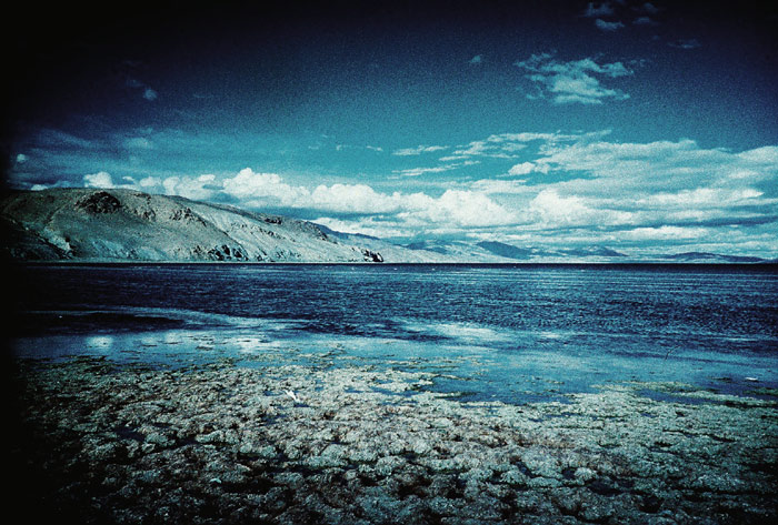
Lake Mansarovar, 4,590 m — one of the highest freshwater lakes in the world.

The two lakes

Mansarovar (Mapham Yumtso, “the unconquerable lake”) is round, calm and fresh, about 88 km around and up to 90 m deep. Hindus bathe in it and drink from it; Buddhists associate it with Queen Maya’s dream before the birth of the Buddha. Pilgrims circle it too, today mostly by vehicle, stopping at Chiu Gompa on the north-west shore for the classic view of Kailash across the water.

Rakshastal (Lhanag Tso), a few kilometres west, is its opposite: crescent-shaped, salt, windswept and without fish. It is the lake of the demon king Ravana, who is said to have done penance on its shore. A short channel, the Ganga Chhu, links the two; Tibetans take water flowing through it as a good omen.

Together the pair are read as sun and moon, light and dark. South of them rises Gurla Mandhata (7,694 m), the highest peak in the region.

The kora (parikrama)

The pilgrimage is a walk around the mountain, not up it: 52 km, almost all of it above 4,600 m. Hindus, Buddhists and Jains go clockwise; followers of Bon go the other way. Most visitors take three days. Many Tibetans do it in one, starting before dawn.

Day 1

Darchen → Tarboche → Dirapuk

about 20 km · 6–7 hrs · sleep near 5,000 m

Past the Tarboche flagpole and Chuku monastery, up the Lha Chu valley beneath the west face. The north face fills the sky above Dirapuk monastery at dusk.

Day 2

Dirapuk → Dolma La → Zutulpuk

about 22 km · 8–10 hrs · high point ~5,630 m

The hard day. A steep climb past Shiva Tsal, where pilgrims leave a piece of clothing or a lock of hair as a symbolic death, to the prayer flags of the Dolma La. Below the pass lies Gauri Kund, the frozen lake of Parvati. A long descent leads to Zutulpuk, where Milarepa’s cave is.

Day 3

Zutulpuk → Darchen

about 10 km · 3–4 hrs

An easy walk down the Zhong Chu valley and out onto the plain, with Rakshastal and Gurla Mandhata ahead, closing the circle at Darchen.

Tibetan pilgrims on the Kailash kora
Tibetan pilgrims on the kora. Ponies and porters can be hired at Darchen for those who cannot walk the whole way.
The north face of Mount Kailash
The north face from Dirapuk, the first night’s halt.

Tarboche. Each year at Saga Dawa, the full moon of the fourth Tibetan month (May or June), a great prayer-flag pole is taken down and raised again here. It is the busiest week of the year.

The inner kora. A shorter, higher circuit on the south side passes closer to the mountain. By tradition it is open only to those who have completed thirteen outer koras.

Mansarovar parikrama. The circuit of the lake is about 88 km. It was once a four-day walk; most groups now drive it in a few hours.

Why no one has climbed it

Kailash is not especially high and not, by the standards of modern mountaineering, especially hard. It is unclimbed because the people to whom it belongs do not want it climbed. To set foot on the summit would be to walk on the seat of the gods.

Outsiders have looked. In 1926 Hugh Ruttledge and R. C. Wilson studied the north face and the north-east ridge and ran out of time. Herbert Tichy asked about an attempt in 1936 and was told by a local chief that only a man entirely free of sin could do it. In the 1980s Reinhold Messner was offered the chance by the Chinese authorities and turned it down.

In 2001 reports that a Spanish expedition had been given permission caused protests from climbers and religious groups around the world. The attempt did not go ahead, and China has since said that climbing on Kailash is not allowed. In Tibetan tradition the only person ever to reach the top was Milarepa, nine hundred years ago.

Getting there

Kailash is in Tibet, so every route ends at a Chinese border post, and independent travel is not possible: you go with a registered group, a guide and a set of permits. There are five ways in.

RouteHow it goesDaysGood to know
Lipulekh Pass, UttarakhandDelhi → Dharchula → Gunji → Lipulekh → Taklakot → Mansarovar → Darchen. The official Indian route, and the oldest.about 22Government yatra only. Mostly by road now, with some walking at altitude.
Nathu La, SikkimDelhi → Gangtok → Nathu La → Kangma → Lazi → Zhongba → Mansarovar → Darchen.about 21Government yatra only. Motorable all the way, so easier on older pilgrims; longer drive in Tibet.
Overland from KathmanduKathmandu → Rasuwagadhi / Kerung → Saga → Mansarovar → Darchen, and back the same way.12–14The usual route for private groups. Gradual height gain, with rest days at Kerung and Saga.
By helicopter via SimikotKathmandu → Nepalgunj → Simikot → Hilsa by air, then road through Taklakot to Mansarovar.9–11Fastest, and dearest. Height is gained quickly and flights depend on weather, so allow spare days.
Via LhasaFly to Lhasa, then drive west through Shigatse and Saga — about 1,200 km.14–16Best acclimatisation, with the monasteries of central Tibet on the way.
From India · official yatra

The Kailash Manasarovar Yatra

The Ministry of External Affairs runs the yatra each summer in cooperation with China. It was suspended from 2020 and resumed in 2025. In 2026 it ran from June to August for 1,000 pilgrims, in twenty batches of fifty, split between the two passes.

  • 1Open to Indian citizens aged 18 to 70 with a valid passport. Selection is by computerised draw.
  • 2A medical examination is compulsory, with a body-mass-index limit of 25.
  • 3Lipulekh takes about 22 days; Nathu La, which is motorable throughout, about 21.
  • 4Press estimates for 2026 put the cost near ₹2.1 lakh by Lipulekh and ₹3.3 lakh by Nathu La.

These are the 2026 arrangements as reported in the press. Dates, numbers, costs and rules are set afresh each year — check the Ministry’s yatra portal, kmy.gov.in, before you plan.

Satellite view of Mount Kailash with lakes Mansarovar and Rakshastal
From orbit: Kailash and the two lakes to its south — round Mansarovar to the east, crescent Rakshastal to the west.

Before you go

When to go

May to September. May, June and September have the clearest skies. July and August are warmer but the monsoon can close the roads on the Nepal and Uttarakhand approaches. Nights are below freezing in every month.

Altitude

You sleep above 4,500 m for a week and cross 5,630 m on foot. Altitude sickness, not distance, is the real risk. Good itineraries add rest days on the way in; never skip them, and descend if symptoms worsen.

Fitness

Start walking daily two to three months ahead, with hills or stairs. See your doctor before booking, and again for any altitude medication — do not self-prescribe.

Permits

A Chinese group visa plus Tibet travel, alien travel and military permits. Your operator arranges all of them from your passport copy, usually four to six weeks ahead. Rules for different nationalities change, so confirm early.

On the kora

Basic guesthouses at Dirapuk and Zutulpuk, with shared rooms and simple food. Ponies and porters are hired at Darchen. Carry a down jacket, a rain shell, a head torch and cash in yuan.

Respect

Walk in the direction of your own tradition and give way to those prostrating. Do not bathe with soap in the lake, take stones, or photograph pilgrims and soldiers without asking.

The Panch Kailash

Hindu tradition counts five abodes of Shiva in the Himalaya. Kailash in Tibet is the first. The other four are in India and can be reached without a foreign visa:

  • Adi Kailash5,945 m, Pithoragarh, Uttarakhand — “little Kailash”, with Om Parvat on the same road
  • Kinnaur Kailash6,050 m, Kinnaur, Himachal Pradesh — a 24 m rock pillar worshipped as a Shivling
  • Shrikhand Mahadev5,227 m, Kullu, Himachal Pradesh — one of the hardest pilgrim treks in India
  • Manimahesh Kailash5,653 m, Chamba, Himachal Pradesh — above the sacred Manimahesh lake

Since 2024 pilgrims have also been able to see Kailash itself from Indian soil, from a viewpoint near Old Lipulekh Pass in Pithoragarh.

Om Parvat in Uttarakhand
Om Parvat, Uttarakhand — snow lies in the shape of the sacred syllable on its face.

Heights and distances are rounded and vary a little between surveys. The yatra figures are for 2026 as reported by the Indian press. Photographs: Wikimedia Commons contributors (CC BY-SA) and NASA.

Ready when you are

Tell us your dream trek. We’ll map the route.

Share your dates, fitness and the peaks you’re chasing — and get a tailored itinerary and honest budget in return.

Plan your trek WhatsApp us

WhatsApp us