Himālaya · “abode of snow”

The Great Himalaya

The youngest, highest mountains on earth — 2,400 km of rock and ice that make the monsoon, feed three of Asia’s great rivers and hold the faith of more than a billion people. This is the range we walk in, explained.

At a glance

2,400kmLong, from Nanga Parbat in the west to Namcha Barwa in the east
5Countries share it — India, Nepal, Bhutan, China (Tibet) and Pakistan
10 of 14Of the world’s 8,000 m peaks stand here; the other four are in the Karakoram
8,848.86mMount Everest — Sagarmatha, Chomolungma — the highest point on earth
~50million yrsSince India collided with Asia. In mountain terms, a newborn
3Great river systems rise here — the Indus, the Ganga and the Brahmaputra

The name is Sanskrit: hima, snow, and ālaya, dwelling. The range runs in a long arc, 150 to 400 km wide, between the plains of the Indus and Ganga to the south and the Tibetan Plateau to the north. It is not one wall but several parallel ranges, each higher than the last.

How it formed

Around 50 million years ago the Indian plate, drifting north across an ocean called the Tethys, ran into Eurasia. Neither plate would sink beneath the other, so the crust between them crumpled, stacked and rose. The sea floor that lay between the two continents was lifted into the sky.

The proof is underfoot. The summit of Everest is marine limestone laid down in a warm, shallow sea. In the Kali Gandaki valley of Nepal, black ammonite fossils — shaligram, sacred to Vishnu — wash out of rock that was once seabed.

The collision has not stopped. India still pushes north by a few centimetres a year, and the range is still rising by millimetres. That same pressure is released in earthquakes, such as the one that struck Nepal in April 2015. Rivers and glaciers cut the mountains down almost as fast as they grow, which is why the valleys are so deep and the slopes so steep.
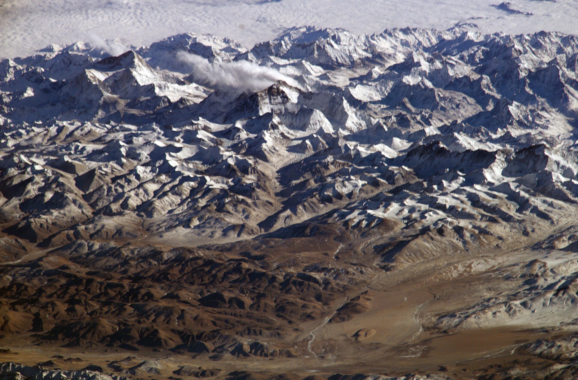

The Himalaya seen from space
From orbit: the green Ganga plain, the white arc of the Himalaya and the brown Tibetan Plateau beyond.

Four ranges, south to north

Walk north from the plains and you climb a staircase. Each step is a separate range with its own height, weather and way of life.

Gangetic plain Shivalik600–1,500 m Lesser Himalaya1,500–4,500 m Great Himalaya6,000–8,849 m Trans-HimalayaTibetan Plateau · around 4,500 m SOUTHNORTH
01

Shivalik the outer hills

Low, crumbling ridges of gravel and sandstone washed down from the higher ranges. Sal forest, tigers and elephants, and the flat valleys called duns behind them — Dehradun is one.

02

Lesser Himalaya Himachal

The middle hills, where most Himalayan people live. Terraced farms, oak and deodar forest and the old hill stations — Shimla, Mussoorie, Nainital, Darjeeling. Nag Tibba stands here.

03

Great Himalaya Himadri

The main crest: a near-continuous line of snow peaks averaging over 6,000 m, with every 8,000 m summit of the range. Glaciers, high passes and the base camps trekkers dream about.

04

Trans-Himalaya beyond the crest

The Zanskar, Ladakh and Kailash ranges, in the rain shadow of the main wall. A cold, dry high desert of bare rock, blue lakes and monasteries — Ladakh, Spiti and Upper Mustang.

The giants

Fourteen mountains on earth rise above 8,000 metres. Ten of them are in the Himalaya, and eight of those stand wholly or partly in Nepal.

#PeakHeightWhereFirst climbedSee it on
1 Mount EverestSagarmatha · Chomolungma 8,849 m Nepal · Tibet 1953 — Tenzing Norgay & Edmund Hillary Everest Base Camp
2 KangchenjungaKhangchendzonga 8,586 m Nepal · India (Sikkim) 1955 — Joe Brown & George Band Goecha La
3 Lhotse 8,516 m Nepal · Tibet 1956 — Ernst Reiss & Fritz Luchsinger Everest Base Camp
4 Makalu 8,485 m Nepal · Tibet 1955 — Lionel Terray & Jean Couzy Mera Peak Expedition
5 Cho Oyu 8,188 m Nepal · Tibet 1954 — Herbert Tichy, Joseph Jöchler & Pasang Dawa Lama Gokyo Lakes
6 Dhaulagiri I 8,167 m Nepal 1960 — Kurt Diemberger, Peter Diener, Ernst Forrer, Albin Schelbert, Nyima Dorje & Nawang Dorje Poon Hill
7 ManasluKutang 8,163 m Nepal 1956 — Toshio Imanishi & Gyalzen Norbu Manaslu Circuit
8 Nanga ParbatDiamir 8,126 m Gilgit-Baltistan 1953 — Hermann Buhl, alone and without bottled oxygen —
9 Annapurna I 8,091 m Nepal 1950 — Maurice Herzog & Louis Lachenal Annapurna Base Camp
10 ShishapangmaGosainthan · Xixabangma 8,027 m Tibet 1964 — A ten-member team led by Xu Jing —
The Kangchenjunga range seen from Sikkim
Kangchenjunga, 8,586 m — the third-highest mountain on earth and the highest in India, on the Sikkim–Nepal border.
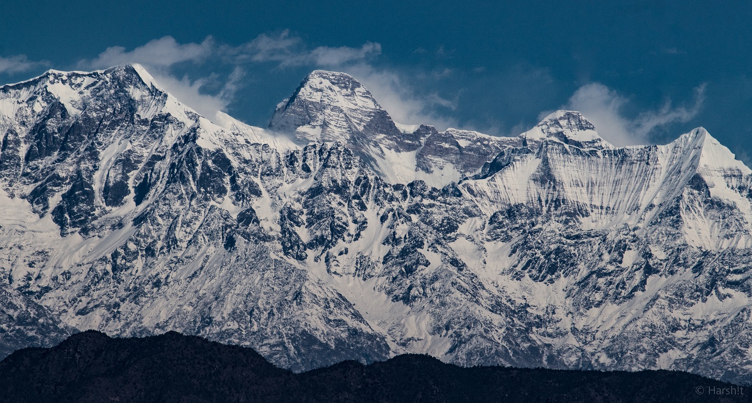
Nanda Devi seen from Ranikhet
Nanda Devi, 7,816 m — the highest mountain entirely within India, ringed by a wall of peaks in Uttarakhand.

All fourteen 8,000 m peaks, one by one →

The two ends. The range is anchored by Nanga Parbat (8,126 m), where the Indus bends south, and Namcha Barwa (7,782 m), where the Brahmaputra does the same.

Still unclimbed. Gangkhar Puensum (7,570 m) in Bhutan is the highest mountain no one has stood on. Bhutan does not permit climbing above 6,000 m, out of respect for local belief.

K2 is not Himalayan. The world’s second-highest peak stands in the Karakoram, a separate range north-west across the Indus.

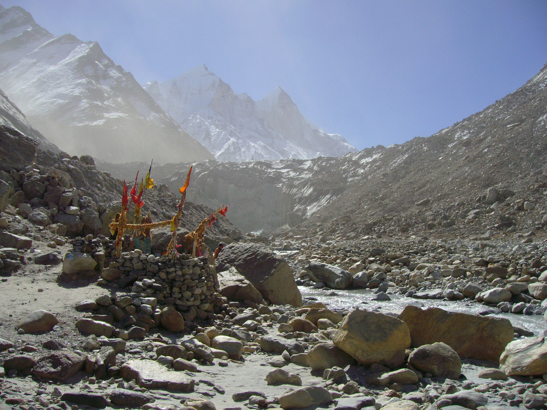
Gaumukh, the snout of the Gangotri glacier
Gaumukh, “the cow’s mouth” — the snout of the Gangotri glacier, where the Bhagirathi, the main source stream of the Ganga, begins.

Rivers & ice

Outside the poles, no region on earth holds more ice. The Himalaya carries roughly 15,000 glaciers, which is why the wider mountain system is called the Third Pole. Gangotri, about 30 km long, is among the largest in India; the Khumbu flows off Everest itself.

That ice and the monsoon snow feed three river systems. The Indus, the Sutlej and the Brahmaputra (as the Yarlung Tsangpo) all rise close to Mount Kailash in Tibet and flow away in opposite directions. The Ganga is born on the Indian side, from Gaumukh and the streams that join it at Devprayag. The Yamuna begins at Yamunotri.

Several of these rivers are older than the mountains. They held their course while the range rose around them, sawing gorges straight through the main crest. The Kali Gandaki runs between Dhaulagiri and Annapurna, both over 8,000 m, in what is by some measures the deepest gorge in the world.

Downstream, these waters irrigate the plains of India, Pakistan, Nepal and Bangladesh. The mountain research centre ICIMOD estimates that close to two billion people depend on rivers that begin in the Hindu Kush Himalaya.

Climate & life

The Himalaya makes the weather of the subcontinent. It stops the summer monsoon and wrings the rain out over India and Nepal, leaving Tibet dry. In winter it blocks the freezing winds of Central Asia. The east is far wetter than the west, and the monsoon arrives in June and leaves in September.

One mountainside, five worlds

Climb 6,000 metres and you pass through as many climates as a journey from the tropics to the Arctic. The heights below are typical for the central Himalaya.

Above 5,000 m

Snow & rock

Permanent snow, glaciers and bare rock. Lichens and little else. Half the oxygen of sea level.

3,800–5,000 m

Alpine meadow

The bugyals: grass and wildflowers in summer, snow in winter. Blue poppy, brahma kamal, bharal and snow leopard.

3,000–3,800 m

Subalpine forest

Silver fir, birch and dwarf rhododendron up to the treeline. Musk deer, monal pheasant and Himalayan tahr.

1,500–3,000 m

Temperate forest

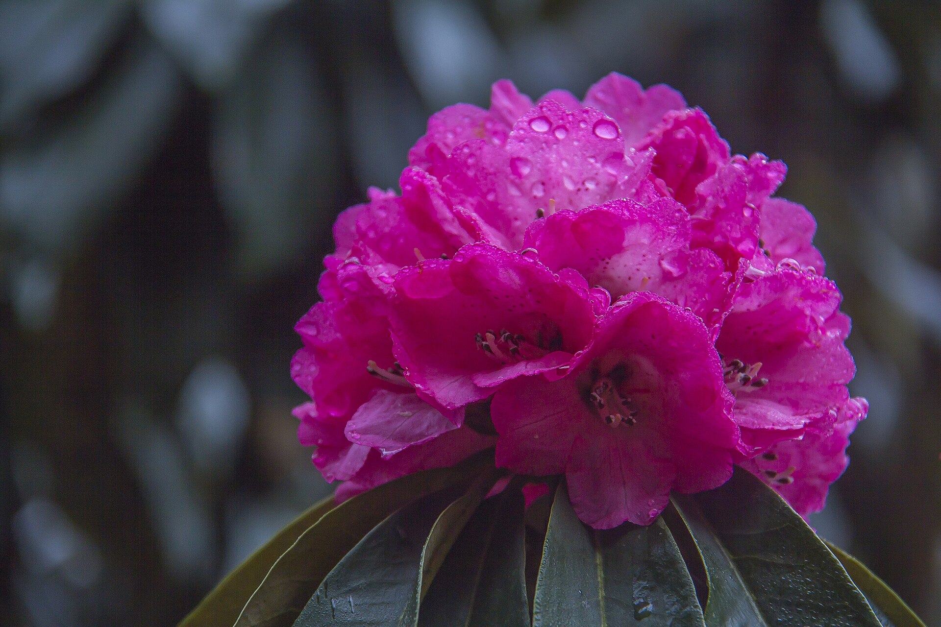
Oak, deodar, pine and tree rhododendron, red with flowers in March and April. Black bear, leopard and, in the east, red panda.

Below 1,500 m

Foothill forest

Sal and bamboo, hot and humid. Elephant, tiger and rhinoceros in the Terai parks at the mountain’s foot.

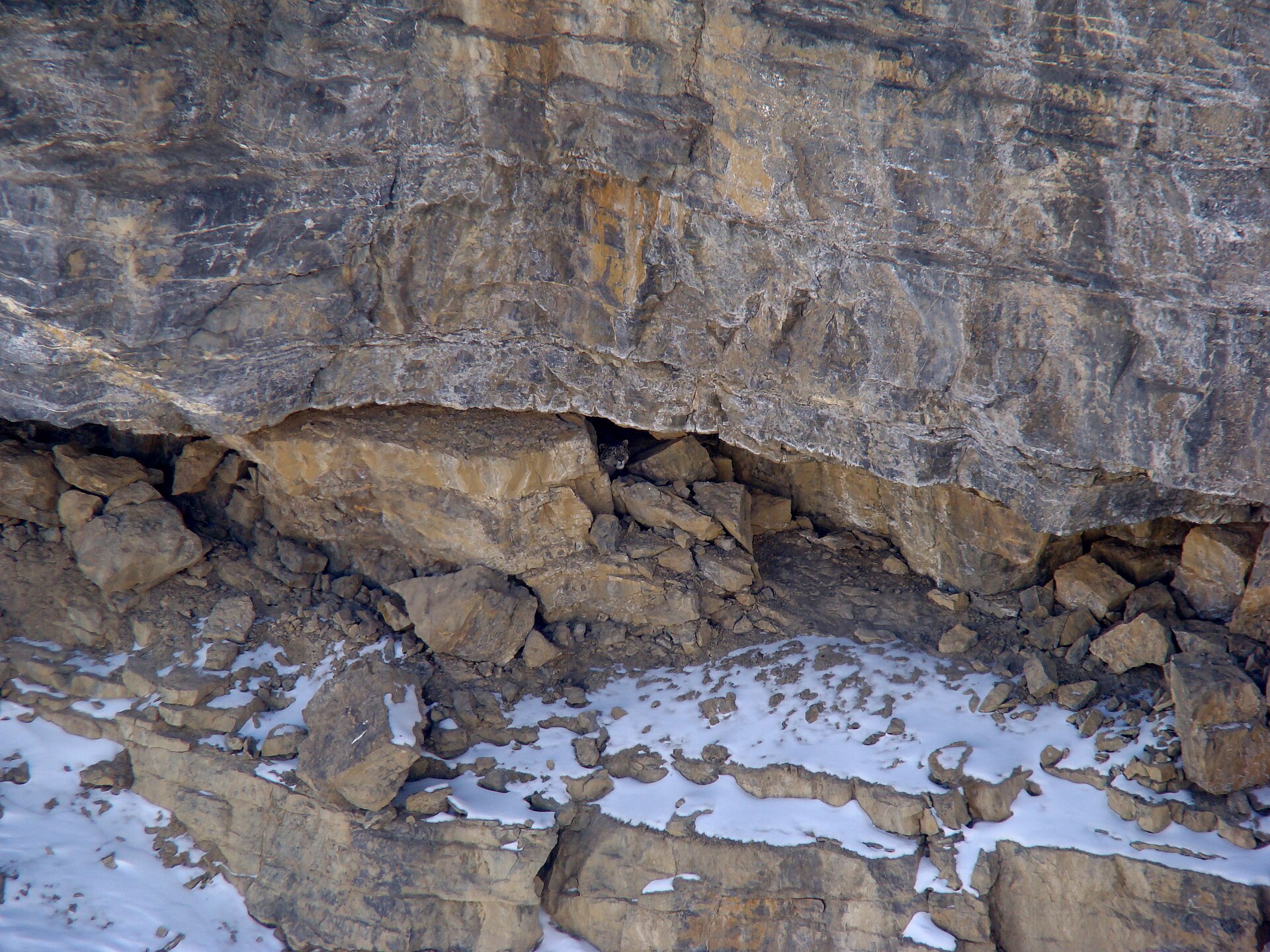
A snow leopard
Snow leopard — the “ghost of the mountains”, at home above 3,000 m. Hemis National Park in Ladakh is one of the best places to look for one.
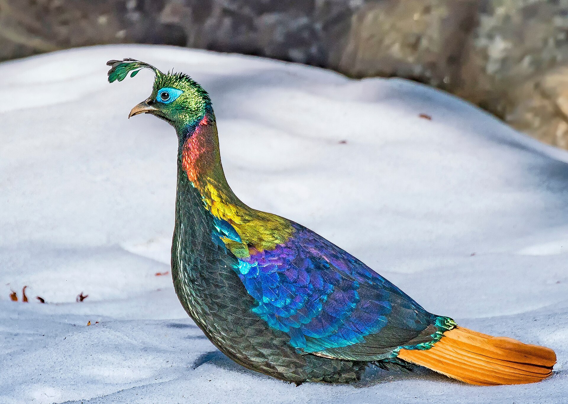
A Himalayan monal on snow
Himalayan monal — the national bird of Nepal and the state bird of Uttarakhand.
Red rhododendron flowers
Tree rhododendron — lali gurans, the national flower of Nepal; burans, the state tree of Uttarakhand.

World Heritage. UNESCO lists four Himalayan parks on these trails: Sagarmatha in Nepal, and in India the Nanda Devi and Valley of Flowers parks, the Great Himalayan National Park and Khangchendzonga.

The high flyer. Bar-headed geese cross the range twice a year on migration and have been tracked flying above 7,000 m.

People & faith

Tens of millions of people live in these mountains, in hundreds of communities with their own languages. Sherpa, Gurung, Tamang and Thakali in Nepal. Lepcha and Bhutia in Sikkim. Garhwali, Kumaoni and the Bhotia traders of the high valleys in Uttarakhand. Gaddi shepherds in Himachal, Ladakhis and Changpa nomads on the plateau, and Gujjar and Bakarwal herders in Kashmir.

For centuries they farmed terraces, moved flocks up and down with the seasons, and carried salt, wool and grain over the passes between India and Tibet. Many of today’s trekking routes are their old trade and grazing trails.

To much of Asia the Himalaya is holy ground. Hindus call Uttarakhand Dev Bhoomi, the land of the gods: Shiva lives on Kailash, the Ganga descends at Gangotri, and pilgrims walk to Kedarnath, Badrinath and the Panch Kedar. Buddhists built monasteries from Hemis to Tengboche; the Buddha was born at Lumbini, in the plains below the range. Sikhs climb to Hemkund Sahib. Mount Kailash is sacred to Hindus, Buddhists, Jains and followers of Bon alike, and has never been climbed. Read our guide to Mount Kailash →

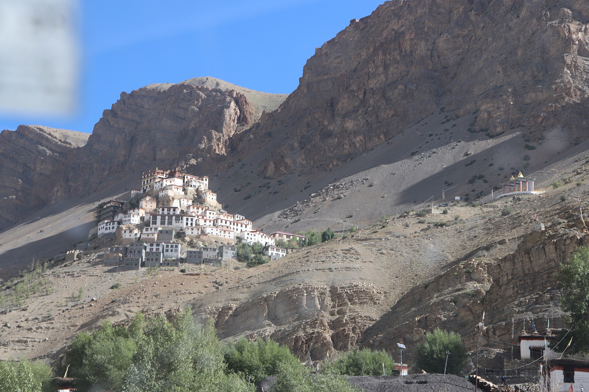
Key Monastery in the Spiti valley
Key Monastery, Spiti — a thousand-year-old gompa at 4,166 m in the Trans-Himalaya.

Measuring and climbing it

  1. ~50 million years ago

    India meets Asia

    The Indian plate collides with Eurasia and the floor of the Tethys Sea begins to rise.

  2. 1852

    The highest peak is found

    Radhanath Sikdar, a Bengali mathematician with the Great Trigonometrical Survey of India, computes that “Peak XV” is the highest in the world. It is named Mount Everest in 1865.

  3. 1950

    The first 8,000 m summit

    A French team led by Maurice Herzog climbs Annapurna I — before any reliable map of the mountain existed.

  4. 29 May 1953

    Everest

    Tenzing Norgay and Edmund Hillary reach the summit by the South Col route.

  5. 1965

    India on top

    An Indian expedition led by Captain M. S. Kohli puts nine climbers on the summit of Everest.

  6. 1975

    The first woman

    Junko Tabei of Japan becomes the first woman to climb Everest.

  7. 1978

    Without bottled oxygen

    Reinhold Messner and Peter Habeler climb Everest breathing only the air.

  8. 1984

    Bachendri Pal

    Born in a village in Uttarkashi, she becomes the first Indian woman to climb Everest.

  9. 1988

    Nanda Devi protected

    Nanda Devi National Park is inscribed as a UNESCO World Heritage Site; the Valley of Flowers is added in 2005.

  10. 2020

    8,848.86 metres

    Nepal and China jointly announce a new official height for Everest.

Ama Dablam in the Khumbu
Ama Dablam above the Khumbu. Glaciers across the region are thinning and retreating.

A fragile future

The Himalaya is warming faster than the world average, and the ice shows it. A 2023 assessment by ICIMOD found that glaciers across the Hindu Kush Himalaya lost ice 65% faster in 2011–2020 than in the decade before, and could lose up to 80% of their present volume by 2100 if emissions stay high.

Less ice means swollen rivers now and less water later. Melt also fills unstable lakes behind walls of moraine, which can burst without warning. Steep young mountains, heavier rain and new roads and dams add landslides and floods, as Kedarnath saw in 2013 and Chamoli in 2021.

Trekking is part of this picture, for good and bad. It brings income to remote valleys, and it brings litter, firewood cutting and crowding to the popular ones. What we ask of everyone who walks with us:

  • 1Carry out everything you carry in — wrappers, bottles, batteries.
  • 2Stay on the trail and camp where others have; meadows take years to heal.
  • 3Hire local guides, eat local food, stay in village homes where you can.
  • 4Consider a quieter route. See our low-traffic trails →

Now walk it

Figures are rounded and drawn from standard survey and reference sources; the glacier figures are from ICIMOD’s 2023 assessment. Photographs: Wikimedia Commons contributors (CC BY-SA) and NASA.

Ready when you are

Tell us your dream trek. We’ll map the route.

Share your dates, fitness and the peaks you’re chasing — and get a tailored itinerary and honest budget in return.

Plan your trek WhatsApp us

WhatsApp us